Showing posts with label Touring. Show all posts

13 June, 2011

Today: Dead Man's Beach

Dugongs
Kicked north of town on the Kickbike. Pass the paddock where there's always a  small mob of kangaroos lying about, squizin at the passing traffic. They come in from the scrub to lounge around and know that no one can get through the fence between them and the road.
 (Further north -- 15 km -- along the coast at Toorbul on Pumice Stone Passage the kangaroos have literally 'taken over' the town and will jump about in folks front and back yards while the traffic and dog regulations are synced to roo friendly).
It's almost an Australian caricature. Hell: it is a caricature!

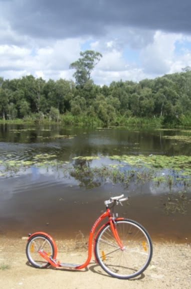
Headed another 6 km along the coast road and passed, what I call, Black Swan Lake because it is full of black swans. Tidal with a fresh water spring feeding it, in its ringed by mangroves and runs parallel to the shore 50 metres away. The road used to be rough going because of potholes and I had given up traversing it -- but since the big flood in January inundated the lot, repairs have now delivered a nice piece of asphalt.

I dismounted at the end of the bitumen and locked my bike to a Tea Tree/ Paperbark and went down the track through the dense scrub to the beach. The tide was on the way out --already 500 metres from high tide shore line when I got there -- so I walked another few kilometres north to Godwin Beach where the sea grass beds come close into shore and the sand gives way to mud flats.
Godwin used to be called Dead Man's Beach because the corpses of drowned flood victims from the Brisbane River Valley used to habitually wash up there.
Off shore the sea grass beds extend in a wide underwater Prairie and reports suggest that despite the silting that has occurred because of the recent massive amount of floodwater coming down the rivers, the seagrass beds in Moreton Bay have faired quite well and the Dugong population has not been denied vegetative sustenance through silting. 

Dugongs -- or Sea Cows -- are marine mammals like porpoises and wales which can grow to 9 feet in length.

 I hope to sail the sea grass beds soon as I build up my kayaking strength in the hope of seeing these creatures that are now under threat. The Bay population is supposedly around 600-800  with herds of 100 animals. Most dugongs, however, are to be found further out on the Moreton and Amity Banks.  Once upon a time they were like buffalo or wildebeests  upon a great underwater grassland in both Hervey and Moreton Bays but today their numbers have crashed through exploitation and urbanisation.
"Early accounts indicate that dugong numbers pre-commercial harvest were substantial. As an example: “One of the fishermen of Wide Bay told the writer…he had seen a mob which appeared to fill the water with their bodies. He computed this school ... to be half a mile wide and from three to four miles long…The writer’s boat once anchored in Hervey’s bay, in one of those channels through which the tide passes when running off the flats. For between three and four hours there was a continuous stream of dugong passing while the tide went out, which those in the boat could only liken to the rush of cattle out of a stockyard after a general muster ... some thousands must have gone out with the tide.” Thorne, E. (1876). Queen of the Colonies.
En route back wading the shallows, juvenile Shovel Nose Rays (similar to Banjo or Fiddler Rays of the Americas) played at my feet. They actually do swim around your tootsies when the local Estuary Stingrays will flounce off  in haste. 

Back on the scooter for the homewood push...Dived upon by two Butcher Birds -- in the middle of Winter! What gives? So when I get home I attached a couple of cable/zippy ties to my bike helmet and that always keeps the diving birds -- magpies especially -- at a distance during nesting season (which should not be happening until much later in the year).

Zippy tie-ing for bird strike protection: It's one of the very few advantages of compulsory helmet wearing...

31 March, 2008

To Shultz's Canal

Salt marsh lands with She Oaks, Shultz's Canal
Old German Cemetery Zion Hill Nundah

Audio to follow. Check back...

26 March, 2008

Gmaps pedometer

Gmaps pedometer: mapping my preferred tour route:
http://www.gmap-pedometer.com/?r=1730578
Click on map image to enlarge view.
15.17km as measured

25 March, 2008

Stepping it all the way from Pieterburen to St Petersburg


The small village of Pieterburen is situated in the northern part of the province of Groningen in the Netherlands. And St Petersburg is located on the Neva River at the east end of the Gulf of Finland on the Baltic Sea.

22 March, 2008

Shultz's Canal tour

I live 10 kilometres from the Brisbane CBD on the shoulder of the airport. So I get to ride the bike track that runs along Kedron Brook and Shultz's Canal to Nudgee Beach.

If I start from home and travel south toward Toombul shoppingtown or I short cut via the old German Cemetery(the area was first settled by German missionaries who sought to bring christianity to the local Turrbul peoples) Either way I reach Kedron Brook -- I can then turn east to ride the bike track, then arc back home at the Nudgee Waterhole, past the Golden Circle Cannery to home.

Bikeway Map
Click to enlarge view

I've now established this as my preferred 'run'. It's about 12 kilometres.

If you can deal with the snakes -- green tree snakes and yellow belly black snakes -- who frequent the parkway, either in the long grass chasing a bird donated dinner of eggs or basking on the asphalt --it's an inspiring journey.

Shultz's Canal

When they built the Brisbane airport they diverted Kedron Brook around it and created this straightline canal which borders the airport on its north edge. The canal is tidal up to Sandgate Road and is surprisingly busy with fish life. When this shot was taken some kids were catching mullet fry in the canal and had had their line taken by a shark. This strip is often used to catch bait fish and crustaceans.
Salty Waterfall

The creek at the end of my street in Northgate used to be a series of w freshwater waterholes (see my Cannery Creek blog) but with the engineering for the airport they deepened the creek so that today it is tidal. The gums died off, the turtles disappeared, the waterlilies died and mangroves colonized the riparian verges and it became a factory drain

But where the creek meets Shultz's Canal each day there's a two way waterfall as the incoming or outgoing tide rushes over a ford.You sit by it and think you are off somewhere else in the bush.

[Note my front wheel panniers -- click image to enlarge view.]

02 December, 2007

To Nudgee Beach by kickbike

I finally got myself a set of front wheel panniers and this AM attached them(as shown to left) to the front forks.

To celebrate the greatly increased carrying capacity I kicked myself to Nudgee Beach which for me is the next stop east of the Nudgee Waterholes [past the southern border of the Boondall Wetlands.

It's something of a northside bicycling standard as the Shultz Canal and Kedron Brook bike path leads directly there.

My fare was an OK steak sandwich at Pam's Cafe -- the only store in Nudgee Beach --with a little bit too much beetroot. I am not a beetroot supporter.

I then traversed the mangroves walk. A view of that route is seen in this image below -- Nudgee Creek inlet looking north.

I rehydrated myself.

Then turned my two wheels west.

The tragedy was for some others that as I traversed my route east in the first instance there was a northbound traffic jam on the Gateway Arterial when I crossed it via the overpass. Then on my way back that gridlock was still there.

Oh the joys, the joys of a Sunday drive!

So I scooted above the traffic stopped to check out the turtles in the waterholes then proceeded to the pub to purchase a couple of bottles of cheap wine.

The route home is more or less down hill past the Golden Circle Cannery.

And in my panniers: the vino.

14 October, 2007

Nudgee Waterholes


The main game is to head off as many mornings as I can in a north eastery direction. Down my suburban street, across the Cannery Creek foot bridge; past the Golden Circle ("pineapple")Cannery; climb the Banyo Hill; pass the high school and Catholic University; along the cemetery to the Nudgee Waterholes.

Voila!

There I dismount; cast a weathered eye across the water to note the water lilly blooms and water birds; check to see if the turtles are rushing up to me --as they inevitably do -- do a circuit of the lake by circumventing the bora ring*

Is this a special place? For me the whole area is where I live. Its geography ecology and urbanology; its history and pre-history. I work at being informed and appreciate the consequences of it being a swamp.

So now, with my kickbike I get to range wider than my daily walks had enabled me. So each day now I can commune with the Nudgee Water Holes: a perennial pond fed from a spring which rises in the cemetery in the slope above it. Fed by the rotting corpses of dead white people -- the waterholes and its bora rings were a major ceremonial site of the Turrubul people in the "Brisbane" district up until 1860 when the last corroboree was held here.

The ring intersected with a major pathway which led to the Bunya Mountains where mass gatherings of indigenous groupings were held to coincide with the bunya nut ripenings in the Bunya Mountains(image below) -- on the Great Dividing Range.


The first whites traversed this area in 1823 -- three lost (and rather stupid) ex convicts who had been "ship" wrecked and lost on one of the Moreton bay Islands.

John Finnegan, Thomas Pamphlet and Richard Parsons were sailing from Sydney to Illawarra(!) to take on a cargo of timber when they were blown off course by a gale. Eventually they were shipwrecked on Moreton Island on 15 April 1823. They walked north along the beach to Cape Moreton, then continued along the northern shore and down the western side of the island to the South Passage. They crossed the South Passage by native canoe, and found the natives at Amity Point most hospitable. Eventually they built a canoe of their own, in which they crossed to Peel Island and then to the mainland near Cleveland. They followed the Brisbane River upstream as far as Oxley Creek on foot. They reached Redcliffe (NB:north of the current waterholes site--DR)on 30 June, and by late September were at Pumicestone Channel near Point Skirmish (Bribie Island), enjoying the patronage of the local people.

They made an excursion to the north (Thinking they could make it to Sydney that way! --DR), but Pamphlet and Finnegan each returned to Point Skirmish; Parsons was last seen by Finnegan in the vicinity of Noosa. Pamphlet and Finnegan were found at Point Skirmish by John Oxley on 29 and 30 November, respectively.Source

Now look at it! Freeways, airports, dormitory suburbs, Catholic Church as the major local land owner(paying no council rates on its real estate holdings until the 1990s), Golden Circle is curently selling itself to a new bidder rather than be swallowed up by Coca Cola Amatil, a sewerage plant, creek slime....

And among it all is me on a kickbike.

*A Bora is the name given both to an initiation ceremony of Indigenous Australians, and to the site on which the initiation is performed. At such a site, young boys are transformed into men. The initiation ceremony differs from culture to culture, but often involves circumcision and scarification, and may also involve the removal of a tooth or part of a finger. The ceremony, and the process leading up to it, involves the learning of sacred songs, stories, dances, and traditional lore. Many different clans will assemble to participate in an initiation ceremony.

Bora rings, found in South-East Australia, are circles of foot-hardened earth surrounded by raised embankments. They were generally constructed in pairs (although some sites have three), with a bigger circle about 22 metres in diameter and a smaller one of about 14 metres. The rings are joined by a sacred walkway.